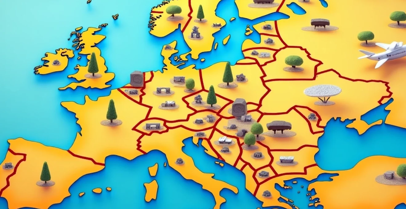
Planning a European adventure requires more than simply booking flights and accommodation. The key to unlocking an extraordinary journey across this diverse continent lies in mastering the art of strategic cartographic planning . Modern travellers have access to sophisticated mapping technologies that can transform a basic itinerary into a meticulously crafted exploration route, optimising everything from transportation costs to cultural experiences.
Europe’s intricate network of railways, highways, and waterways presents both opportunities and challenges for travellers. A well-planned mapping strategy enables you to navigate the continent’s 50+ countries efficiently whilst uncovering hidden gems that traditional guidebooks might overlook. Whether you’re embarking on a two-week cultural immersion or a months-long backpacking odyssey, understanding how to leverage mapping tools will significantly enhance your travel experience and potentially save thousands in transportation and accommodation costs.
The complexity of European geography, with its varied terrains ranging from Scandinavian fjords to Mediterranean coastlines, demands a comprehensive approach to route planning. By combining digital mapping platforms with traditional cartographic analysis, you can create personalised itineraries that account for seasonal variations, transportation schedules, and regional attractions whilst maintaining flexibility for spontaneous discoveries.
Digital mapping platforms and route planning software for european travel
The digital revolution has transformed how travellers approach European route planning, offering unprecedented access to real-time data and interactive mapping tools. Modern platforms combine satellite imagery, crowd-sourced information, and artificial intelligence to provide comprehensive travel intelligence that was previously available only to professional tour operators. These sophisticated systems enable travellers to visualise complex multi-country itineraries whilst accounting for variables such as visa requirements, seasonal accessibility, and cultural events.
Contemporary mapping platforms have evolved beyond simple navigation tools to become comprehensive travel planning ecosystems. They integrate accommodation databases, transportation schedules, weather forecasts, and user reviews to create dynamic planning environments. The most effective European travel planning combines multiple platforms, each offering unique strengths and specialised features for different aspects of journey organisation.
Google maps offline download features for Multi-Country itineraries
Google Maps remains the cornerstone of digital travel planning, offering robust offline capabilities essential for European travel. The platform allows users to download detailed maps for entire regions, ensuring navigation remains possible even in areas with limited connectivity. For European travellers, this feature proves invaluable when exploring rural areas, underground metro systems, or when managing data roaming costs across multiple countries.
The offline download feature supports maps covering up to 120,000 square kilometres per download, sufficient to cover most European countries entirely. Advanced users can create custom map collections, downloading specific regions along their planned route whilst maintaining detailed city centre coverage for major destinations. This strategic downloading approach ensures comprehensive coverage without consuming excessive device storage space.
Michelin route planner integration with historical sites database
Michelin’s route planning platform excels in combining practical navigation with cultural enrichment opportunities. The system integrates comprehensive databases of UNESCO World Heritage sites, historical landmarks, and cultural attractions, enabling travellers to optimise routes for maximum educational value. This approach particularly benefits those seeking to understand European history through geographical exploration.
The platform’s scenic route algorithms identify paths that balance travel efficiency with visual appeal, often revealing lesser-known historical sites and architectural marvels. Michelin’s expertise in European road networks ensures route suggestions account for seasonal road conditions, toll costs, and fuel efficiency whilst highlighting culturally significant waypoints that enhance the overall travel experience.
Rome2rio Multi-Modal transport coordination across EU nations
Rome2Rio specialises in complex multi-modal transportation planning across Europe’s interconnected transport networks. The platform excels at identifying optimal combinations of flights, trains, buses, and ferries to connect distant European destinations efficiently. This capability proves particularly valuable when planning routes between peripheral regions or when seeking cost-effective alternatives to direct flights.
The system’s strength lies in its comprehensive database of regional transport operators, including budget airlines, intercity bus services, and ferry connections. Rome2Rio’s algorithms consider total journey time, cost variations, and connection reliability to suggest practical alternatives that mainstream booking platforms often overlook. This comprehensive transport intelligence enables travellers to discover surprising routing options that can significantly reduce travel costs whilst adding interesting destinations to their itinerary.
Komoot hiking trail mapping for alpine routes and coastal paths
Komoot provides specialised mapping for outdoor enthusiasts exploring Europe’s diverse landscapes. The platform offers detailed topographical data, elevation profiles, and surface condition information essential for planning hiking, cycling, and outdoor adventure routes. European travellers benefit from Komoot’s extensive coverage of marked trails, mountain paths, and coastal walking routes across the continent.
The platform’s community-driven approach provides real-time trail condition updates and seasonal accessibility information. Users can plan multi-day trekking routes with precise distance calculations, difficulty assessments, and waypoint identification. Komoot’s integration with weather services and local tourism information creates comprehensive outdoor adventure planning that accounts for safety considerations and optimal timing for challenging routes.
Cartographic analysis techniques for european geographic regions
Understanding European geography through systematic cartographic analysis forms the foundation of effective travel planning. The continent’s diverse topography, from Arctic tundra to Mediterranean islands, requires region-specific planning approaches that account for seasonal accessibility, transportation infrastructure, and cultural variations. Professional cartographic analysis involves examining multiple map layers including political boundaries, topographical features, climate zones, and infrastructure networks to create comprehensive regional understanding.
Effective European travel planning requires synthesising information from various cartographic sources, each providing different perspectives on the same geographical areas. Political maps reveal visa requirements and border crossing procedures, whilst topographical maps highlight terrain challenges and scenic opportunities. Transportation maps show railway networks and highway systems, whilst climate maps indicate optimal travel timing and seasonal considerations. This multi-layered analytical approach enables travellers to make informed decisions about routing, timing, and activity selection.
Schengen zone border crossing optimization using political maps
Political mapping analysis proves crucial for understanding Schengen Zone regulations and optimising border crossing procedures. The Schengen Area encompasses 27 European countries, allowing passport-free travel between member states whilst maintaining external border controls. Understanding these political boundaries through mapping enables travellers to plan routes that minimise bureaucratic delays and maximise time spent exploring destinations.
Strategic route planning within the Schengen Zone can extend permitted stay durations and reduce visa application requirements for non-EU travellers. Political maps reveal optimal entry and exit points, particularly valuable for travellers from countries requiring specific visa types. Advanced planning using political cartography can identify routes that avoid non-Schengen territories, maintaining continuous visa validity throughout extended European journeys.
Topographical map reading for mediterranean coastal routes
Mediterranean coastal topography presents unique challenges and opportunities for European travellers. The region’s dramatic elevation changes, from sea-level beaches to mountain peaks exceeding 2,000 metres, create microclimates and accessibility variations that significantly impact travel planning. Topographical analysis reveals optimal routes for coastal driving, identifies challenging mountain passes, and highlights scenic viewpoints that justify longer journey times.
Understanding Mediterranean topography through detailed contour mapping enables travellers to anticipate road conditions, estimate journey times accurately, and identify alternative routes during adverse weather conditions. The region’s susceptibility to seasonal storms and temperature extremes makes topographical awareness essential for safe and comfortable travel. Elevation-conscious route planning can reveal spectacular coastal panoramas whilst avoiding potentially dangerous mountain roads during winter months.
Railway network mapping through central european transport hubs
Central Europe’s extensive railway infrastructure forms the backbone of continental transportation, connecting major cities through high-speed corridors and regional networks. Railway network mapping reveals strategic hub cities that enable efficient multi-destination travel whilst identifying less obvious routing options that can reduce costs and travel times. Understanding railway geography enables travellers to plan itineraries that maximise the extensive European rail network.
Strategic railway mapping identifies major interchange points such as Vienna, Munich, and Prague, which serve as gateways to multiple regions. These hub cities often warrant extended visits whilst serving as bases for exploring surrounding areas via efficient rail connections. Advanced railway planning reveals overnight train options that combine accommodation and transportation costs whilst enabling travellers to wake up in new destinations without losing sightseeing time.
Climate zone identification using weather pattern overlays
European climate diversity spans from Arctic conditions in northern Scandinavia to subtropical Mediterranean zones, creating complex planning considerations for multi-region itineraries. Climate mapping analysis reveals optimal travel timing for specific regions whilst highlighting seasonal phenomena such as midnight sun in northern territories or monsoon patterns affecting southern regions. Understanding these patterns through cartographic analysis enables strategic timing that maximises comfort and accessibility.
Weather pattern overlays reveal how geographical features influence local climates, creating microzones with distinct characteristics. Mountain ranges create rain shadows, coastal areas moderate temperature extremes, and urban heat islands affect city climates. This climatological intelligence enables travellers to pack appropriately, time outdoor activities optimally, and avoid regions during unfavourable weather periods whilst identifying unique seasonal experiences such as Northern Lights visibility or spring wildflower blooms.
Strategic route optimisation through major european transport corridors
Europe’s major transport corridors represent centuries of strategic infrastructure development, connecting distant regions through efficient multi-modal networks. These corridors, such as the Rhine Valley, Danube River system, and Mediterranean coastal highways, offer travellers opportunities to experience diverse cultures and landscapes whilst maintaining efficient transportation connections. Understanding these established corridors enables strategic route planning that balances cultural immersion with practical logistics.
Transport corridor optimisation involves identifying primary routes that connect multiple destinations of interest whilst providing backup options during disruptions. Major European corridors typically offer multiple transportation modes, including railways, highways, and waterways, enabling flexible routing based on seasonal conditions, budget constraints, and time availability. Strategic corridor planning can transform potentially fragmented journeys into coherent exploration themes that follow historical trade routes or geographical features.
Experienced European travellers understand that following established transport corridors often reveals the continent’s most scenic and culturally rich routes, developed over centuries to connect important centres of commerce and culture.
Rhine valley transportation network integration
The Rhine Valley corridor represents one of Europe’s most integrated transportation networks, connecting Switzerland through Germany to the Netherlands via parallel railway, highway, and waterway systems. This corridor offers exceptional scenic value whilst providing efficient connections to major cities including Basel, Strasbourg, Mannheim, Cologne, and Amsterdam. Rhine Valley routing enables travellers to experience diverse cultures and landscapes whilst maintaining consistent transportation options.
Rhine River cruises provide unique perspectives unavailable through land-based transportation, whilst parallel railway and highway networks offer flexibility for independent exploration. The corridor’s dense infrastructure enables short-distance exploration between major cities, with regional trains and bus services connecting smaller towns and attractions. This multi-modal accessibility makes the Rhine Valley ideal for travellers seeking comprehensive regional exploration without vehicle dependency.
Iberian peninsula coastal highway system navigation
The Iberian Peninsula’s coastal highway system provides spectacular routing options along both Atlantic and Mediterranean coastlines, connecting diverse cultural regions from Portuguese fishing villages to Spanish resort towns. These routes combine dramatic scenery with efficient transportation links, enabling travellers to experience varied landscapes whilst maintaining coastal proximity. Strategic coastal routing reveals hidden beaches, traditional settlements, and regional culinary specialities often missed by inland travellers.
Coastal highway planning must account for seasonal accessibility variations, as some routes become congested during summer months whilst others offer enhanced accessibility and services. Winter coastal travel often provides improved accommodation availability and reduced costs whilst maintaining mild weather conditions suitable for outdoor activities. Understanding seasonal patterns enables optimal timing for coastal exploration that balances weather conditions with tourism infrastructure availability.
Scandinavian ferry route coordination with overland travel
Scandinavian geography necessitates strategic ferry route integration for comprehensive regional exploration. The region’s numerous islands, fjords, and isolated peninsulas rely on ferry connections that enable access to otherwise unreachable destinations. Understanding ferry schedules and seasonal variations proves crucial for planning comprehensive Scandinavian itineraries that include remote natural attractions and traditional communities.
Ferry route coordination requires advance planning due to limited seasonal schedules and vehicle capacity restrictions on popular routes. Summer months offer extensive ferry services enabling island-hopping adventures, whilst winter schedules focus on essential transportation links. Strategic ferry planning can reveal spectacular scenic routes through fjord systems and archipelagos that provide unique perspectives on Scandinavian landscapes unavailable through overland travel.
Accommodation proximity mapping using geographic information systems
Geographic Information Systems (GIS) technology revolutionises accommodation planning by analysing spatial relationships between lodging options and points of interest. Modern GIS platforms enable travellers to visualise accommodation locations relative to transportation hubs, cultural attractions, and activity centres whilst considering factors such as walking distances, public transport accessibility, and neighbourhood characteristics. This analytical approach ensures accommodation selections optimise convenience whilst enhancing overall travel experiences.
Advanced accommodation mapping considers multiple variables simultaneously, including proximity to airports, railway stations, city centres, and specific attractions. The technology reveals patterns invisible through traditional booking platforms, such as seasonal price variations based on location, accessibility during different times of day, and neighbourhood safety characteristics. Strategic accommodation mapping enables travellers to minimise transportation costs and maximise time spent exploring destinations rather than commuting between distant lodging and activity centres.
GIS analysis also reveals clustering opportunities where single accommodation bases enable exploration of multiple attractions. For European travellers, this approach can identify strategic locations that provide access to several cities or regions through efficient day-trip routing. Accommodation clustering strategies reduce packing and unpacking frequency whilst enabling deeper regional exploration through repeated visits to areas of particular interest.
Modern mapping platforms integrate real-time availability data with spatial analysis, revealing last-minute accommodation opportunities in optimal locations. This capability proves particularly valuable during peak tourist seasons when prime locations typically book months in advance. Dynamic mapping analysis can identify emerging neighbourhood accommodation options that offer authentic cultural experiences whilst maintaining accessibility to major attractions.
Budget allocation framework based on regional economic zones
European economic diversity creates significant budget planning challenges, with costs varying dramatically between regions and countries. Western European capitals typically require substantially higher daily budgets compared to Central or Eastern European destinations, whilst rural areas generally offer better value regardless of country. Understanding these economic patterns through mapping enables strategic budget allocation that maximises travel experiences within financial constraints.
Regional economic mapping reveals opportunities for strategic routing that balances expensive destinations with more affordable areas. Travellers can plan itineraries that include premium destinations whilst extending overall trip duration through time spent in budget-friendly regions. This approach enables comprehensive European exploration without concentrating entire budgets on a few expensive cities, allowing for more diverse cultural experiences and longer travel periods.
Strategic budget allocation based on regional economic patterns can extend European travel duration by up to 50% compared to traditional uniform daily budget approaches, enabling deeper cultural immersion and more comprehensive continental exploration.
Economic zone analysis also reveals seasonal budget variations that can significantly impact travel costs. Mediterranean destinations experience dramatic price fluctuations between summer and off-season periods, whilst northern European cities maintain more consistent pricing throughout the year. Understanding these patterns enables strategic timing that maximises value whilst avoiding peak season crowding and inflated costs.
Currency zone mapping within the Eurozone reveals additional budget considerations, as exchange rate fluctuations affect non-Euro travellers differently across regions. Strategic routing can minimise currency conversion costs whilst taking advantage of favourable exchange rates in specific regions. This financial geographic intelligence enables sophisticated budget management that accounts for both regional cost variations and currency considerations.
Emergency navigation protocols and backup mapping resources
Comprehensive European travel planning must include robust emergency protocols and backup navigation resources to address technology failures, unexpected route changes, and emergency situations. Remote areas throughout Europe may lack reliable mobile connectivity, whilst urban areas can experience network congestion during emergencies or major events. Developing multi-layered navigation backup systems ensures travel continuity regardless of technological or infrastructure disruptions.
Emergency mapping protocols should include offline digital maps, traditional paper maps, and multiple navigation applications with different data sources. This redundant approach ensures navigation capability during device failures, battery depletion, or network outages. Strategic backup planning identifies key waypoints, emergency services locations, and communication centres that provide essential services during unexpected situations.
Physical backup mapping resources remain valuable despite digital technology advances, particularly for remote hiking areas or during extended power outages. Traditional topographical maps provide comprehensive terrain information without technology dependency, whilst local tourism office maps often include current road conditions and temporary route changes unavailable through digital platforms. Hybrid navigation strategies combine digital convenience with physical reliability for comprehensive emergency preparedness.
Emergency contact mapping identifies embassy locations, medical facilities, and emergency services across planned routes. This information proves crucial for travellers visiting multiple countries with varying emergency procedures and contact protocols. Advanced emergency planning includes understanding regional emergency contact numbers, medical insurance provider networks, and communication protocols for contacting home countries during emergencies. Understanding these emergency resources through geographical mapping creates essential safety networks that enhance travel security whilst providing peace of mind for comprehensive European exploration.